Kategorie:Pläne und Kartenwerke
Aus FürthWiki
Seiten in der Kategorie „Pläne und Kartenwerke“
Folgende 23 Seiten sind in dieser Kategorie, von 23 insgesamt.
Medien in der Kategorie „Pläne und Kartenwerke“
Folgende 200 Dateien sind in dieser Kategorie, von 748 insgesamt.
(vorherige Seite) (nächste Seite) 001 Friedhof-Rundgang .jpg 2.327 × 1.572; 1,07 MB
 002 Friedhof-Rundgang.jpeg 2.496 × 3.440; 1,33 MB
 1 Altstadtblaeddla 51, 2017-2018 Plan Martin + Michael.png 937 × 705; 690 KB
 1 Altstadtblaeddla 51, 2017-2018 Radargramm.png 926 × 871; 476 KB
 1 Ansicht 4 Jaherszeiten 1951.jpg 6.795 × 3.978; 10,85 MB
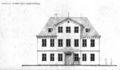
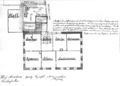 1 Grundriss 4 Jahreszeiten 1906.jpg 7.080 × 5.057; 6,35 MB
 1 Gänsberg-Plan Katharinenstraße 1 bzw, 1 ½.jpg 3.258 × 2.872; 5,56 MB
 1 Gänsberg-Plan Katharinenstraße 10.jpg 3.258 × 2.872; 5,57 MB
 1 Gänsberg-Plan Katharinenstraße 11.png 3.258 × 2.872; 15,98 MB
 1 Gänsberg-Plan Katharinenstraße 12.jpg 3.258 × 2.872; 5,57 MB
 1 Gänsberg-Plan Katharinenstraße 18.jpg 3.258 × 2.872; 5,57 MB
 1 Gänsberg-Plan Katharinenstraße 2.jpg 3.258 × 2.872; 5,57 MB
 1 Gänsberg-Plan Katharinenstraße 4.jpg 3.258 × 2.872; 5,57 MB
 1 Gänsberg-Plan Katharinenstraße 5.jpg 3.258 × 2.872; 5,57 MB
 1 Gänsberg-Plan Katharinenstraße 6.jpg 3.258 × 2.872; 5,57 MB
 1 Gänsberg-Plan Katharinenstraße 8.jpg 3.258 × 2.872; 5,57 MB
 1 Gänsberg-Plan Latteierhof.jpg 5.472 × 4.752; 9,88 MB
 1 Gänsberg-Plan Markgrafengasse 1.jpg 7.258 × 6.399; 31,28 MB
 1 Gänsberg-Plan Markgrafengasse 10.jpg 7.258 × 6.399; 31,34 MB
 1 Gänsberg-Plan Markgrafengasse 12.jpg 7.258 × 6.399; 31,34 MB
 1 Gänsberg-Plan Markgrafengasse 14.jpg 7.258 × 6.399; 31,34 MB
 1 Gänsberg-Plan Markgrafengasse 16.jpg 7.258 × 6.399; 31,34 MB
 1 Gänsberg-Plan Markgrafengasse 2.jpg 7.258 × 6.399; 31,35 MB
 1 Gänsberg-Plan Markgrafengasse 3.jpg 7.258 × 6.399; 31,35 MB
 1 Gänsberg-Plan Markgrafengasse 4.jpg 7.258 × 6.399; 31,34 MB
 1 Gänsberg-Plan Markgrafengasse 5.jpg 7.258 × 6.399; 31,32 MB
 1 Gänsberg-Plan Markgrafengasse 6.jpg 7.258 × 6.399; 31,34 MB
 1 Gänsberg-Plan Markgrafengasse 7.jpg 7.258 × 6.399; 31,33 MB
 1 Gänsberg-Plan Markgrafengasse 8.jpg 7.258 × 6.399; 31,33 MB
 1 Gänsberg-Plan Markgrafengasse 9.jpg 7.258 × 6.399; 31,33 MB
 1 Gänsberg-Plan Markgrafengasse a.jpg 7.258 × 6.399; 31,43 MB
 1 Gänsberg-Plan roh Berth Doktorshof..jpg 5.472 × 4.752; 9,88 MB
 1 Gänsberg-Plan roh Berth Königstraße 48..jpg 5.472 × 4.752; 9,88 MB
 1 Gänsberg-Plan roh Berth Königstraße 50.jpg 5.472 × 4.752; 9,87 MB
 1 Gänsberg-Plan roh Berth Königstraße 52..jpg 5.472 × 4.752; 9,88 MB
 1 Gänsberg-Plan roh Berth Königstraße 54.jpg 5.472 × 4.752; 9,88 MB
 1 Gänsberg-Plan roh Berth Königstraße 56.jpg 5.472 × 4.752; 9,87 MB
 1 Gänsberg-Plan roh Berth Königstraße 58..jpg 5.472 × 4.752; 9,87 MB
 1 Gänsberg-Plan roh Berth Königstraße 60..jpg 5.472 × 4.752; 9,88 MB
 1 Gänsberg-Plan roh Berth Königstraße 62..jpg 5.472 × 4.752; 9,88 MB
 1 Gänsberg-Plan roh Berth Königstraße 64.jpg 5.472 × 4.752; 9,87 MB
 1 Gänsberg-Plan roh Berth Königstraße 66..jpg 5.472 × 4.752; 9,88 MB
 1 Gänsberg-Plan roh Berth Lilienstraße 10.jpg 5.472 × 4.752; 8,93 MB
 1 Gänsberg-Plan roh Berth Lilienstraße 12..jpg 5.472 × 4.752; 8,94 MB
 1 Gänsberg-Plan roh Berth Lilienstraße 14.jpg 5.472 × 4.752; 8,94 MB
 1 Gänsberg-Plan roh Berth Lilienstraße 16.jpg 5.472 × 4.752; 8,93 MB
 1 Gänsberg-Plan roh Berth Lilienstraße 18..jpg 5.472 × 4.752; 8,94 MB
 1 Gänsberg-Plan roh Berth Lilienstraße 2.jpg 5.472 × 4.752; 8,94 MB
 1 Gänsberg-Plan roh Berth Lilienstraße 20.jpg 5.472 × 4.752; 8,94 MB
 1 Gänsberg-Plan roh Berth Lilienstraße 4..jpg 5.472 × 4.752; 8,94 MB
 1 Gänsberg-Plan roh Berth Lilienstraße 6.jpg 5.472 × 4.752; 8,94 MB
 1 Gänsberg-Plan roh Berth Lilienstraße 8.jpg 5.472 × 4.752; 8,94 MB
 1 Gänsberg-Plan roh Berth Lilienstraße..jpg 5.472 × 4.752; 5,82 MB
 1 Gänsberg-Plan roh Berth. Bergstraße 1.jpg 5.472 × 4.752; 9,9 MB
 1 Gänsberg-Plan roh Berth. Bergstraße 10 und 12.jpg 5.472 × 4.752; 9,92 MB
 1 Gänsberg-Plan roh Berth. Bergstraße 11.jpg 5.472 × 4.752; 9,9 MB
 1 Gänsberg-Plan roh Berth. Bergstraße 13.jpg 5.472 × 4.752; 9,9 MB
 1 Gänsberg-Plan roh Berth. Bergstraße 14.jpg 5.472 × 4.752; 9,92 MB
 1 Gänsberg-Plan roh Berth. Bergstraße 15.jpg 5.472 × 4.752; 9,9 MB
 1 Gänsberg-Plan roh Berth. Bergstraße 16 a.jpg 5.472 × 4.752; 9,92 MB
 1 Gänsberg-Plan roh Berth. Bergstraße 17.jpg 5.472 × 4.752; 9,9 MB
 1 Gänsberg-Plan roh Berth. Bergstraße 18.jpg 5.472 × 4.752; 9,92 MB
 1 Gänsberg-Plan roh Berth. Bergstraße 19.jpg 5.472 × 4.752; 9,9 MB
 1 Gänsberg-Plan roh Berth. Bergstraße 2.jpg 5.472 × 4.752; 9,91 MB
 1 Gänsberg-Plan roh Berth. Bergstraße 20.jpg 5.472 × 4.752; 9,91 MB
 1 Gänsberg-Plan roh Berth. Bergstraße 21.jpg 5.472 × 4.752; 9,92 MB
 1 Gänsberg-Plan roh Berth. Bergstraße 23.jpg 5.472 × 4.752; 9,92 MB
 1 Gänsberg-Plan roh Berth. Bergstraße 24.jpg 5.472 × 4.752; 9,92 MB
 1 Gänsberg-Plan roh Berth. Bergstraße 25.jpg 5.472 × 4.752; 9,92 MB
 1 Gänsberg-Plan roh Berth. Bergstraße 27.jpg 5.472 × 4.752; 9,92 MB
 1 Gänsberg-Plan roh Berth. Bergstraße 28.jpg 5.472 × 4.752; 9,92 MB
 1 Gänsberg-Plan roh Berth. Bergstraße 4 mit 6.jpg 5.472 × 4.752; 9,89 MB
 1 Gänsberg-Plan roh Berth. Bergstraße 7.jpg 5.472 × 4.752; 9,92 MB
 1 Gänsberg-Plan roh Berth. Bergstraße 8.jpg 5.472 × 4.752; 9,89 MB
 1 Gänsberg-Plan roh Berth. Bergstraße 9.jpg 5.472 × 4.752; 9,92 MB
 1 Gänsberg-Plan roh Berth. Bergstraße.jpg 5.472 × 4.752; 9,9 MB
 1 Gänsberg-Plan roh Berth. Geleitsgasse 1.jpg 5.472 × 4.752; 9,89 MB
 1 Gänsberg-Plan roh Berth. Geleitsgasse 13.jpg 5.472 × 4.752; 9,88 MB
 1 Gänsberg-Plan roh Berth. Geleitsgasse 2.jpg 5.472 × 4.752; 9,89 MB
 1 Gänsberg-Plan roh Berth. Geleitsgasse 3.jpg 5.472 × 4.752; 9,89 MB
 1 Gänsberg-Plan roh Berth. Geleitsgasse 4.jpg 5.472 × 4.752; 9,89 MB
 1 Gänsberg-Plan roh Berth. Geleitsgasse 5.jpg 5.472 × 4.752; 9,88 MB
 1 Gänsberg-Plan roh Berth. Geleitsgasse 6jpg.jpg 5.472 × 4.752; 9,89 MB
 1 Gänsberg-Plan roh Berth. Geleitsgasse.jpg 5.472 × 4.752; 9,89 MB
 1 Gänsberg-Plan roh Berth. Löwenplatz 10.jpg 5.472 × 4.752; 9,88 MB
 1 Gänsberg-Plan roh Berth. Löwenplatz 12.jpg 5.472 × 4.752; 9,88 MB
 1 Gänsberg-Plan roh Berth. Löwenplatz 4.jpg 5.472 × 4.752; 9,88 MB
 1 Gänsberg-Plan roh Berth. Löwenplatz 6.jpg 5.472 × 4.752; 9,88 MB
 1 Gänsberg-Plan roh Berth. Löwenplatz 8.jpg 5.472 × 4.752; 9,88 MB
 1 Gänsberg-Plan roh Berth. Rednitzstraße 14.jpg 5.472 × 4.752; 9,88 MB
 1 Gänsberg-Plan roh Berth. Rednitzstraße 15.jpg 5.472 × 4.752; 9,88 MB
 1 Gänsberg-Plan roh Berth. Rednitzstraße 2.jpg 5.472 × 4.752; 9,88 MB
 1 Gänsberg-Plan roh Berth. Rednitzstraße 21.jpg 5.472 × 4.752; 9,89 MB
 1 Gänsberg-Plan roh Berth. Rednitzstraße 22.jpg 5.472 × 4.752; 9,88 MB
 1 Gänsberg-Plan roh Berth. Rednitzstraße 23.jpg 5.472 × 4.752; 9,88 MB
 1 Gänsberg-Plan roh Berth. Rednitzstraße 25.jpg 5.472 × 4.752; 9,88 MB
 1 Gänsberg-Plan roh Berth. Rednitzstraße 27.jpg 5.472 × 4.752; 9,88 MB
 1 Gänsberg-Plan roh Berth. Rednitzstraße 28.jpg 5.472 × 4.752; 9,88 MB
 1 Gänsberg-Plan roh Berth. Rednitzstraße 29.jpg 5.472 × 4.752; 9,88 MB
 1 Gänsberg-Plan roh Berth. Rednitzstraße 3.jpg 5.472 × 4.752; 9,89 MB
 1 Gänsberg-Plan roh Berth. Rednitzstraße 32.jpg 5.472 × 4.752; 9,88 MB
 1 Gänsberg-Plan roh Berth. Rednitzstraße 34.jpg 5.472 × 4.752; 9,88 MB
 1 Gänsberg-Plan roh Berth. Rednitzstraße 36.jpg 5.472 × 4.752; 9,88 MB
 1 Gänsberg-Plan roh Berth. Rednitzstraße 38.jpg 5.472 × 4.752; 9,88 MB
 1 Gänsberg-Plan roh Berth. Rednitzstraße 4.jpg 5.472 × 4.752; 9,88 MB
 1 Gänsberg-Plan roh Berth. Rednitzstraße 40.jpg 5.472 × 4.752; 9,88 MB
 1 Gänsberg-Plan roh Berth. Rednitzstraße 5.jpg 5.472 × 4.752; 9,88 MB
 1 Gänsberg-Plan roh Berth. Rednitzstraße 6.jpg 5.472 × 4.752; 9,88 MB
 1 Gänsberg-Plan roh Berth. Rednitzstraße 7.jpg 5.472 × 4.752; 9,89 MB
 1 Gänsberg-Plan roh Berth. Rednitzstraße 9, 11, 13.jpg 5.472 × 4.752; 9,88 MB
 1 Gänsberg-Plan roh Berth. Schützenhof 1.jpg 5.472 × 4.752; 9,89 MB
 1 Gänsberg-Plan roh Berth. Schützenhof 10.jpg 5.472 × 4.752; 9,89 MB
 1 Gänsberg-Plan roh Berth. Schützenhof 11.jpg 5.472 × 4.752; 9,88 MB
 1 Gänsberg-Plan roh Berth. Schützenhof 2.jpg 5.472 × 4.752; 9,89 MB
 1 Gänsberg-Plan roh Berth. Schützenhof 3.jpg 5.472 × 4.752; 9,89 MB
 1 Gänsberg-Plan roh Berth. Schützenhof 4 und 4a.jpg 5.472 × 4.752; 9,89 MB
 1 Gänsberg-Plan roh Berth. Schützenhof 5.jpg 5.472 × 4.752; 9,89 MB
 1 Gänsberg-Plan roh Berth. Schützenhof 7.jpg 5.472 × 4.752; 9,89 MB
 1 Gänsberg-Plan roh Berth. Schützenhof.jpg 5.472 × 4.752; 9,89 MB
 1 Gänsberg-Plan roh Berth.Königstraße 68.jpg 5.472 × 4.752; 9,88 MB
 1 Gänsberg-Plan roh Berth.Mohrenstraße 1.jpg 5.472 × 4.752; 9,87 MB
 1 Gänsberg-Plan roh Berth.Mohrenstraße 10.jpg 5.472 × 4.752; 9,88 MB
 1 Gänsberg-Plan roh Berth.Mohrenstraße 11.jpg 5.472 × 4.752; 9,87 MB
 1 Gänsberg-Plan roh Berth.Mohrenstraße 12.jpg 5.472 × 4.752; 9,88 MB
 1 Gänsberg-Plan roh Berth.Mohrenstraße 13.jpg 5.472 × 4.752; 9,87 MB
 1 Gänsberg-Plan roh Berth.Mohrenstraße 14.jpg 5.472 × 4.752; 9,88 MB
 1 Gänsberg-Plan roh Berth.Mohrenstraße 15.jpg 5.472 × 4.752; 9,87 MB
 1 Gänsberg-Plan roh Berth.Mohrenstraße 16 .jpg 5.472 × 4.752; 9,88 MB
 1 Gänsberg-Plan roh Berth.Mohrenstraße 17.jpg 5.472 × 4.752; 9,88 MB
 1 Gänsberg-Plan roh Berth.Mohrenstraße 18.jpg 5.472 × 4.752; 9,87 MB
 1 Gänsberg-Plan roh Berth.Mohrenstraße 19.jpg 5.472 × 4.752; 9,87 MB
 1 Gänsberg-Plan roh Berth.Mohrenstraße 20.jpg 5.472 × 4.752; 9,88 MB
 1 Gänsberg-Plan roh Berth.Mohrenstraße 20a.jpg 5.472 × 4.752; 9,88 MB
 1 Gänsberg-Plan roh Berth.Mohrenstraße 21.jpg 5.472 × 4.752; 9,87 MB
 1 Gänsberg-Plan roh Berth.Mohrenstraße 22 a.jpg 5.472 × 4.752; 9,88 MB
 1 Gänsberg-Plan roh Berth.Mohrenstraße 23.jpg 5.472 × 4.752; 9,87 MB
 1 Gänsberg-Plan roh Berth.Mohrenstraße 24.jpg 5.472 × 4.752; 9,87 MB
 1 Gänsberg-Plan roh Berth.Mohrenstraße 25.jpg 5.472 × 4.752; 9,87 MB
 1 Gänsberg-Plan roh Berth.Mohrenstraße 26.jpg 5.472 × 4.752; 9,87 MB
 1 Gänsberg-Plan roh Berth.Mohrenstraße 28.jpg 5.472 × 4.752; 9,88 MB
 1 Gänsberg-Plan roh Berth.Mohrenstraße 3.jpg 5.472 × 4.752; 9,87 MB
 1 Gänsberg-Plan roh Berth.Mohrenstraße 30.jpg 5.472 × 4.752; 9,87 MB
 1 Gänsberg-Plan roh Berth.Mohrenstraße 32.jpg 5.472 × 4.752; 9,87 MB
 1 Gänsberg-Plan roh Berth.Mohrenstraße 5.jpg 5.472 × 4.752; 9,87 MB
 1 Gänsberg-Plan roh Berth.Mohrenstraße 7.jpg 5.472 × 4.752; 9,88 MB
 1 Gänsberg-Plan roh Berth.Mohrenstraße 8.jpg 5.472 × 4.752; 9,88 MB
 1 Gänsberg-Plan roh Berth.Mohrenstraße 9.jpg 5.472 × 4.752; 9,87 MB
 1 Gänsberg-Plan roh Berth.Mohrenstraße.jpg 5.472 × 4.752; 9,88 MB
 1 Gänsberg-Plan roh Geleitsgasse 7.jpg 5.472 × 4.752; 8,97 MB
 1 Gänsberg-Plan roh Geleitsgasse 8.jpg 5.472 × 4.752; 8,97 MB
 1 Gänsberg-Plan roh Geleitsgasse 9.jpg 5.472 × 4.752; 8,97 MB
 1 Gänsberg-Plan roh Katharinenstraße 14.jpg 3.258 × 2.872; 5,57 MB
 1 Gänsberg-Plan roh Katharinenstraße 16.jpg 3.258 × 2.872; 5,57 MB
 1 Gänsberg-Plan roh Katharinenstraße 22.jpg 7.258 × 6.399; 31,44 MB
 1 Gänsberg-Plan roh Katharinenstraße a.jpg 3.258 × 2.872; 6,46 MB
 1 Gänsberg-Plan roh Klausengässchen.jpg 7.258 × 6.399; 31,42 MB
 1 Gänsberg-Plan roh Königstraße 42.jpg 7.258 × 6.399; 31,36 MB
 1 Gänsberg-Plan roh Schlezerbergla..jpg 5.472 × 4.752; 9,88 MB
 1 Gänsberg-Plan roh Schulhof 1.jpg 7.258 × 6.399; 31,32 MB
 1 Gänsberg-Plan roh Schulhof 2.jpg 7.258 × 6.399; 31,32 MB
 1 Gänsberg-Plan roh Schulhof 3.jpg 7.258 × 6.399; 31,19 MB
 1 Gänsberg-Plan roh Schulhof 4.jpg 7.258 × 6.399; 31,24 MB
 1 Gänsberg-Plan roh Schulhof 5 1,2.jpg 7.258 × 6.399; 31,24 MB
 1 Gänsberg-Plan roh Schulhof 5.jpg 7.258 × 6.399; 31,26 MB
 1 Gänsberg-Plan roh Schulhof 6.jpg 7.258 × 6.399; 31,23 MB
 1 Gänsberg-Plan roh Schulhof.jpg 7.258 × 6.399; 20,1 MB
 1 Gänsberg-Plan Schlehenstraße 1 1,2.png 3.258 × 2.872; 9,1 MB
 1 Gänsberg-Plan Schlehenstraße 2.jpg 3.258 × 2.872; 5,52 MB
 1 Gänsberg-Plan Schlehenstraße.png 3.258 × 2.872; 9,11 MB
 1 Gänsberg-Plan Staudengasse 10.jpg 5.472 × 4.752; 9,89 MB
 1 Gänsberg-Plan Staudengasse 11.jpg 5.472 × 4.752; 9,89 MB
 1 Gänsberg-Plan Staudengasse 14.jpg 5.472 × 4.752; 9,89 MB
 1 Gänsberg-Plan Staudengasse 16.jpg 5.472 × 4.752; 9,89 MB
 1 Gänsberg-Plan Staudengasse 18.jpg 5.472 × 4.752; 9,89 MB
 1 Gänsberg-Plan Staudengasse 2.jpg 5.472 × 4.752; 9,89 MB
 1 Gänsberg-Plan Staudengasse 4.jpg 5.472 × 4.752; 9,88 MB
 1 Gänsberg-Plan Staudengasse 5.jpg 5.472 × 4.752; 9,88 MB
 1 Gänsberg-Plan Staudengasse 7.jpg 5.472 × 4.752; 9,89 MB
 1 Gänsberg-Plan Staudengasse 8.jpg 5.472 × 4.752; 9,89 MB
 1 Gänsberg-Plan Staudengasse 9.jpg 5.472 × 4.752; 9,89 MB
 1 Gänsberg-Plan Staudengasse.6.jpg 5.472 × 4.752; 9,89 MB
 1 Gänsberg-Plan Staudengasse.jpg 5.472 × 4.752; 9,89 MB
 1 Gänsbergplan Stadt Fü Abriss 1956.jpg 6.676 × 4.950; 8 MB
 1 Gänsbergplan Stadt Fü Königstraße 10.jpg 6.676 × 4.950; 7,98 MB
 1 Gänsbergplan Stadt Fü Königstraße 12.jpg 6.676 × 4.950; 7,98 MB
 1 Gänsbergplan Stadt Fü Königstraße 14.jpg 6.676 × 4.950; 7,99 MB
 1 Gänsbergplan Stadt Fü Königstraße 16.jpg 6.676 × 4.950; 7,98 MB
 1 Gänsbergplan Stadt Fü Königstraße 18.jpg 6.676 × 4.950; 7,99 MB
 1 Gänsbergplan Stadt Fü Königstraße 20.jpg 6.676 × 4.950; 7,98 MB
 1 Gänsbergplan Stadt Fü Königstraße 22.jpg 6.676 × 4.950; 7,99 MB
 1 Gänsbergplan Stadt Fü Königstraße 24.jpg 6.676 × 4.950; 7,99 MB
 1 Gänsbergplan Stadt Fü Königstraße 26.jpg 6.676 × 4.950; 7,99 MB
 1 Gänsbergplan Stadt Fü Königstraße 28.jpg 6.676 × 4.950; 7,98 MB
 1 Gänsbergplan Stadt Fü Königstraße 30.jpg 6.676 × 4.950; 7,98 MB
 1 Gänsbergplan Stadt Fü Königstraße 32.jpg 6.676 × 4.950; 7,98 MB
 1 Gänsbergplan Stadt Fü Königstraße 34.jpg 6.676 × 4.950; 7,98 MB
 1 Gänsbergplan Stadt Fü Königstraße 36, 38.jpg 6.676 × 4.950; 7,97 MB
 1 Gänsbergplan Stadt Fü Königstraße 36.jpg 6.676 × 4.950; 7,98 MB
 1 Gänsbergplan Stadt Fü Königstraße 40.jpg 6.676 × 4.950; 7,99 MB
 1 Gänsbergplan Stadt Fü Königstraße 44.jpg 6.676 × 4.950; 7,99 MB


