Kategorie:Pläne und Kartenwerke
Seiten in der Kategorie „Pläne und Kartenwerke“
Folgende 2 Seiten sind in dieser Kategorie, von 18 insgesamt.
(vorherige Seite) (nächste Seite)(vorherige Seite) (nächste Seite)Medien in der Kategorie „Pläne und Kartenwerke“
Folgende 200 Dateien sind in dieser Kategorie, von 642 insgesamt.
(vorherige Seite) (nächste Seite) 1 Gänsberg-Plan roh Berth. Geleitsgasse 4.jpg 5.472 × 4.752; 9,89 MB
 1 Gänsberg-Plan roh Berth. Geleitsgasse 5.jpg 5.472 × 4.752; 9,88 MB
 1 Gänsberg-Plan roh Berth. Geleitsgasse 6jpg.jpg 5.472 × 4.752; 9,89 MB
 1 Gänsberg-Plan roh Berth. Geleitsgasse.jpg 5.472 × 4.752; 9,89 MB
 1 Gänsberg-Plan roh Berth. Rednitzstraße 14.jpg 5.472 × 4.752; 9,88 MB
 1 Gänsberg-Plan roh Berth. Rednitzstraße 15.jpg 5.472 × 4.752; 9,88 MB
 1 Gänsberg-Plan roh Berth. Rednitzstraße 2.jpg 5.472 × 4.752; 9,88 MB
 1 Gänsberg-Plan roh Berth. Rednitzstraße 21.jpg 5.472 × 4.752; 9,89 MB
 1 Gänsberg-Plan roh Berth. Rednitzstraße 22.jpg 5.472 × 4.752; 9,88 MB
 1 Gänsberg-Plan roh Berth. Rednitzstraße 23.jpg 5.472 × 4.752; 9,88 MB
 1 Gänsberg-Plan roh Berth. Rednitzstraße 25.jpg 5.472 × 4.752; 9,88 MB
 1 Gänsberg-Plan roh Berth. Rednitzstraße 27.jpg 5.472 × 4.752; 9,88 MB
 1 Gänsberg-Plan roh Berth. Rednitzstraße 28.jpg 5.472 × 4.752; 9,88 MB
 1 Gänsberg-Plan roh Berth. Rednitzstraße 29.jpg 5.472 × 4.752; 9,88 MB
 1 Gänsberg-Plan roh Berth. Rednitzstraße 3.jpg 5.472 × 4.752; 9,89 MB
 1 Gänsberg-Plan roh Berth. Rednitzstraße 32.jpg 5.472 × 4.752; 9,88 MB
 1 Gänsberg-Plan roh Berth. Rednitzstraße 34.jpg 5.472 × 4.752; 9,88 MB
 1 Gänsberg-Plan roh Berth. Rednitzstraße 36.jpg 5.472 × 4.752; 9,88 MB
 1 Gänsberg-Plan roh Berth. Rednitzstraße 38.jpg 5.472 × 4.752; 9,88 MB
 1 Gänsberg-Plan roh Berth. Rednitzstraße 4.jpg 5.472 × 4.752; 9,88 MB
 1 Gänsberg-Plan roh Berth. Rednitzstraße 40.jpg 5.472 × 4.752; 9,88 MB
 1 Gänsberg-Plan roh Berth. Rednitzstraße 5.jpg 5.472 × 4.752; 9,88 MB
 1 Gänsberg-Plan roh Berth. Rednitzstraße 6.jpg 5.472 × 4.752; 9,88 MB
 1 Gänsberg-Plan roh Berth. Rednitzstraße 7.jpg 5.472 × 4.752; 9,89 MB
 1 Gänsberg-Plan roh Berth. Rednitzstraße 9, 11, 13.jpg 5.472 × 4.752; 9,88 MB
 1 Gänsberg-Plan roh Berth. Schützenhof 1.jpg 5.472 × 4.752; 9,89 MB
 1 Gänsberg-Plan roh Berth. Schützenhof 10.jpg 5.472 × 4.752; 9,89 MB
 1 Gänsberg-Plan roh Berth. Schützenhof 11.jpg 5.472 × 4.752; 9,88 MB
 1 Gänsberg-Plan roh Berth. Schützenhof 2.jpg 5.472 × 4.752; 9,89 MB
 1 Gänsberg-Plan roh Berth. Schützenhof 3.jpg 5.472 × 4.752; 9,89 MB
 1 Gänsberg-Plan roh Berth. Schützenhof 4 und 4a.jpg 5.472 × 4.752; 9,89 MB
 1 Gänsberg-Plan roh Berth. Schützenhof 5.jpg 5.472 × 4.752; 9,89 MB
 1 Gänsberg-Plan roh Berth. Schützenhof 7.jpg 5.472 × 4.752; 9,89 MB
 1 Gänsberg-Plan roh Berth. Schützenhof.jpg 5.472 × 4.752; 9,89 MB
 1 Gänsberg-Plan roh Berth.Königstraße 68.jpg 5.472 × 4.752; 9,88 MB
 1 Gänsberg-Plan roh Berth.Mohrenstraße 1.jpg 5.472 × 4.752; 9,87 MB
 1 Gänsberg-Plan roh Berth.Mohrenstraße 10.jpg 5.472 × 4.752; 9,88 MB
 1 Gänsberg-Plan roh Berth.Mohrenstraße 11.jpg 5.472 × 4.752; 9,87 MB
 1 Gänsberg-Plan roh Berth.Mohrenstraße 12.jpg 5.472 × 4.752; 9,88 MB
 1 Gänsberg-Plan roh Berth.Mohrenstraße 13.jpg 5.472 × 4.752; 9,87 MB
 1 Gänsberg-Plan roh Berth.Mohrenstraße 14.jpg 5.472 × 4.752; 9,88 MB
 1 Gänsberg-Plan roh Berth.Mohrenstraße 15.jpg 5.472 × 4.752; 9,87 MB
 1 Gänsberg-Plan roh Berth.Mohrenstraße 16 .jpg 5.472 × 4.752; 9,88 MB
 1 Gänsberg-Plan roh Berth.Mohrenstraße 17.jpg 5.472 × 4.752; 9,88 MB
 1 Gänsberg-Plan roh Berth.Mohrenstraße 18.jpg 5.472 × 4.752; 9,87 MB
 1 Gänsberg-Plan roh Berth.Mohrenstraße 19.jpg 5.472 × 4.752; 9,87 MB
 1 Gänsberg-Plan roh Berth.Mohrenstraße 20.jpg 5.472 × 4.752; 9,88 MB
 1 Gänsberg-Plan roh Berth.Mohrenstraße 20a.jpg 5.472 × 4.752; 9,88 MB
 1 Gänsberg-Plan roh Berth.Mohrenstraße 21.jpg 5.472 × 4.752; 9,87 MB
 1 Gänsberg-Plan roh Berth.Mohrenstraße 22 a.jpg 5.472 × 4.752; 9,88 MB
 1 Gänsberg-Plan roh Berth.Mohrenstraße 23.jpg 5.472 × 4.752; 9,87 MB
 1 Gänsberg-Plan roh Berth.Mohrenstraße 24.jpg 5.472 × 4.752; 9,87 MB
 1 Gänsberg-Plan roh Berth.Mohrenstraße 25.jpg 5.472 × 4.752; 9,87 MB
 1 Gänsberg-Plan roh Berth.Mohrenstraße 26.jpg 5.472 × 4.752; 9,87 MB
 1 Gänsberg-Plan roh Berth.Mohrenstraße 28.jpg 5.472 × 4.752; 9,88 MB
 1 Gänsberg-Plan roh Berth.Mohrenstraße 3.jpg 5.472 × 4.752; 9,87 MB
 1 Gänsberg-Plan roh Berth.Mohrenstraße 30.jpg 5.472 × 4.752; 9,87 MB
 1 Gänsberg-Plan roh Berth.Mohrenstraße 32.jpg 5.472 × 4.752; 9,87 MB
 1 Gänsberg-Plan roh Berth.Mohrenstraße 5.jpg 5.472 × 4.752; 9,87 MB
 1 Gänsberg-Plan roh Berth.Mohrenstraße 7.jpg 5.472 × 4.752; 9,88 MB
 1 Gänsberg-Plan roh Berth.Mohrenstraße 8.jpg 5.472 × 4.752; 9,88 MB
 1 Gänsberg-Plan roh Berth.Mohrenstraße 9.jpg 5.472 × 4.752; 9,87 MB
 1 Gänsberg-Plan roh Berth.Mohrenstraße.jpg 5.472 × 4.752; 9,88 MB
 1 Gänsberg-Plan roh Geleitsgasse 7.jpg 5.472 × 4.752; 8,97 MB
 1 Gänsberg-Plan roh Geleitsgasse 8.jpg 5.472 × 4.752; 8,97 MB
 1 Gänsberg-Plan roh Geleitsgasse 9.jpg 5.472 × 4.752; 8,97 MB
 1 Gänsberg-Plan roh Katharinenstraße 14.jpg 3.258 × 2.872; 5,57 MB
 1 Gänsberg-Plan roh Katharinenstraße 16.jpg 3.258 × 2.872; 5,57 MB
 1 Gänsberg-Plan roh Katharinenstraße 22.jpg 7.258 × 6.399; 31,44 MB
 1 Gänsberg-Plan roh Katharinenstraße a.jpg 3.258 × 2.872; 6,46 MB
 1 Gänsberg-Plan roh Klausengässchen.jpg 7.258 × 6.399; 31,42 MB
 1 Gänsberg-Plan roh Königstraße 42.jpg 7.258 × 6.399; 31,36 MB
 1 Gänsberg-Plan roh Schlezerbergla..jpg 5.472 × 4.752; 9,88 MB
 1 Gänsberg-Plan roh Schulhof 1.jpg 7.258 × 6.399; 31,32 MB
 1 Gänsberg-Plan roh Schulhof 2.jpg 7.258 × 6.399; 31,32 MB
 1 Gänsberg-Plan roh Schulhof 3.jpg 7.258 × 6.399; 31,19 MB
 1 Gänsberg-Plan roh Schulhof 4.jpg 7.258 × 6.399; 31,24 MB
 1 Gänsberg-Plan roh Schulhof 5 1,2.jpg 7.258 × 6.399; 31,24 MB
 1 Gänsberg-Plan roh Schulhof 5.jpg 7.258 × 6.399; 31,26 MB
 1 Gänsberg-Plan roh Schulhof 6.jpg 7.258 × 6.399; 31,23 MB
 1 Gänsberg-Plan roh Schulhof.jpg 7.258 × 6.399; 20,1 MB
 1 Gänsberg-Plan Schlehenstraße 1 1,2.png 3.258 × 2.872; 9,1 MB
 1 Gänsberg-Plan Schlehenstraße.png 3.258 × 2.872; 9,11 MB
 1 Gänsberg-Plan Staudengasse 10.jpg 5.472 × 4.752; 9,89 MB
 1 Gänsberg-Plan Staudengasse 11.jpg 5.472 × 4.752; 9,89 MB
 1 Gänsberg-Plan Staudengasse 14.jpg 5.472 × 4.752; 9,89 MB
 1 Gänsberg-Plan Staudengasse 16.jpg 5.472 × 4.752; 9,89 MB
 1 Gänsberg-Plan Staudengasse 18.jpg 5.472 × 4.752; 9,89 MB
 1 Gänsberg-Plan Staudengasse 2.jpg 5.472 × 4.752; 9,89 MB
 1 Gänsberg-Plan Staudengasse 4.jpg 5.472 × 4.752; 9,88 MB
 1 Gänsberg-Plan Staudengasse 5.jpg 5.472 × 4.752; 9,88 MB
 1 Gänsberg-Plan Staudengasse 7.jpg 5.472 × 4.752; 9,89 MB
 1 Gänsberg-Plan Staudengasse 8.jpg 5.472 × 4.752; 9,89 MB
 1 Gänsberg-Plan Staudengasse 9.jpg 5.472 × 4.752; 9,89 MB
 1 Gänsberg-Plan Staudengasse.6.jpg 5.472 × 4.752; 9,89 MB
 1 Gänsberg-Plan Staudengasse.jpg 5.472 × 4.752; 9,89 MB
 1 Gänsbergplan Stadt Fü Abriss 1956.jpg 6.676 × 4.950; 8 MB
 1 Gänsbergplan Stadt Fü Königstraße 10.jpg 6.676 × 4.950; 7,98 MB
 1 Gänsbergplan Stadt Fü Königstraße 12.jpg 6.676 × 4.950; 7,98 MB
 1 Gänsbergplan Stadt Fü Königstraße 14.jpg 6.676 × 4.950; 7,99 MB
 1 Gänsbergplan Stadt Fü Königstraße 16.jpg 6.676 × 4.950; 7,98 MB
 1 Gänsbergplan Stadt Fü Königstraße 18.jpg 6.676 × 4.950; 7,99 MB
 1 Gänsbergplan Stadt Fü Königstraße 20.jpg 6.676 × 4.950; 7,98 MB
 1 Gänsbergplan Stadt Fü Königstraße 22.jpg 6.676 × 4.950; 7,99 MB
 1 Gänsbergplan Stadt Fü Königstraße 24.jpg 6.676 × 4.950; 7,99 MB
 1 Gänsbergplan Stadt Fü Königstraße 26.jpg 6.676 × 4.950; 7,99 MB
 1 Gänsbergplan Stadt Fü Königstraße 28.jpg 6.676 × 4.950; 7,98 MB
 1 Gänsbergplan Stadt Fü Königstraße 30.jpg 6.676 × 4.950; 7,98 MB
 1 Gänsbergplan Stadt Fü Königstraße 32.jpg 6.676 × 4.950; 7,98 MB
 1 Gänsbergplan Stadt Fü Königstraße 34.jpg 6.676 × 4.950; 7,98 MB
 1 Gänsbergplan Stadt Fü Königstraße 36, 38.jpg 6.676 × 4.950; 7,97 MB
 1 Gänsbergplan Stadt Fü Königstraße 36.jpg 6.676 × 4.950; 7,98 MB
 1 Gänsbergplan Stadt Fü Königstraße 40.jpg 6.676 × 4.950; 7,99 MB
 1 Gänsbergplan Stadt Fü Königstraße 44.jpg 6.676 × 4.950; 7,99 MB
 1 Gänsbergplan Stadt Fü Königstraße 8.jpg 6.676 × 4.950; 7,98 MB
 1 Lageplan 4 Jahreszeiten 1954.jpg 4.720 × 7.088; 6,02 MB
 1 Lageplan 4 Jahreszeiten Sponsel 1906.jpg 7.940 × 13.950; 12,9 MB
 1200px-DEU Tutorial - Hochladen von Bildern neu.jpg 1.276 × 652; 290 KB
 1632 Situationsplan.jpg 1.786 × 1.105; 426 KB
 1661.jpg 945 × 627; 1,87 MB
 1663 Finckh Bayern (1).png 507 × 630; 547 KB
 1671 Finckh Bayern.png 487 × 631; 559 KB
 1719 Vetter (2).png 858 × 737; 1,1 MB
 1832 Topographischer Atlas.png 647 × 611; 576 KB
 1896 Stadtplan.jpg 1.725 × 1.395; 269 KB
 1916 Anlage-Weinstraße.jpg 1.417 × 1.330; 832 KB
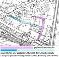 1950er-PL-Bayernstr.jpg 800 × 766; 185 KB
 1956 Geologische Karte (Stöckiggraben).jpg 1.728 × 1.752; 1,06 MB
 197011 Plan Aussegnungshalle Stadeln.jpg 2.336 × 3.558; 2,74 MB
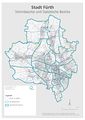 2017 Fuerth Stimm- und statistische Bezirke.jpg 1.655 × 2.340; 481 KB
 20210429 ICE Werk Nuernberg Karte Standorte web-1.jpg 1.170 × 1.170; 251 KB
 772px-Bayern Landtagswahlkreise 2018.svg.png 772 × 708; 221 KB
 A 3164 Heiliggrabkirche 1812.jpg 1.263 × 1.008; 883 KB
 Altenberg Alte Veste.jpeg 6.437 × 5.031; 5,76 MB
 Amalien-50 AR 19-8 Plan.jpg 3.219 × 7.473; 2,91 MB
 Ansicht des neu zu bauenden Wohnhauses Gartenstraße 9, 1839.JPG 3.264 × 2.360; 1,22 MB
 Ansicht Stelen und Bootshaus M 1 zu 35 a.png 589 × 374; 9 KB
 AR 19-32 1.jpg 3.217 × 5.127; 2,07 MB
 Artilleriekaserne 1995.jpg 1.231 × 1.953; 1,16 MB
 Artilleriekaserne 2005.jpg 1.160 × 1.950; 1,07 MB
 Atzenhof Flugplatz Plan 1918.JPG 2.027 × 1.543; 2,99 MB
 Aufriss des Waschhauses, 1839.jpg 1.112 × 1.864; 336 KB
 Aufteilung Grundstück Gran-Leo 1911 Ausschnitt.jpeg 1.233 × 1.232; 486 KB
 Aufteilung Grundstück Gran-Leo 1911.jpg 3.114 × 4.976; 2,89 MB
 Ausländer in Fürth Wohnort.JPG 1.165 × 1.654; 919 KB
 Ausschnitt Stadtwald OpenStreetMap.JPG 1.275 × 671; 178 KB
 Ausschnitt Topographische Karte "Fürth" (GermanyMaps 1954).jpg 1.658 × 1.990; 1,25 MB
 Bahnhof Vach 1886.jpg 3.455 × 2.048; 1,36 MB
 Bahnhof Vach 1899.jpg 3.577 × 1.233; 847 KB
 Bahnhof Vach 1925.pdf 1.406 × 893, 9 Seiten; 31,92 MB
 Baierische Monarchie 1830.png 607 × 507; 548 KB
 Baufeld 1900 TV Fürth 1860.jpg 1.528 × 1.455; 1,55 MB
 Baugenehmigung der Regierung von Mittelfranken,3.5.1839.jpg 2.334 × 2.412; 870 KB
 Baugenehmigung der Stadtmagistrats, 6.5.1839.jpg 2.096 × 2.848; 970 KB
 Bauplan 1899 Schneegasse 7 a.jpg 4.932 × 7.392; 22,4 MB
 Bauplan 1899 Schneegasse 7 e.jpg 4.545 × 6.613; 15,13 MB
 Bauplan 1899 Schneegasse 7 f.jpg 4.896 × 5.592; 14,55 MB
 Bauplan 1899 Schneegasse 7 g.jpg 4.919 × 5.680; 10,67 MB
 Bauplan 1899 Schneegasse 7 h.jpg 4.739 × 5.973; 20,84 MB
 Bauplan 1899 Schneegasse 7 i.jpg 4.978 × 6.300; 17,41 MB
 Baupläne Eigenes heim.jpg 2.606 × 5.021; 3,87 MB
 Bauplätze Lerchen-Peterstr 1867.jpg 5.787 × 4.616; 2,93 MB
 Bayern (Finckh) 1662.png 385 × 430; 294 KB
 Belgien 1747 Ausschnitt.jpg 1.709 × 777; 380 KB
 Belgien 1747.jpg 724 × 604; 179 KB
 Bergbräu Kelleranlage 1944.jpg 953 × 1.417; 890 KB
 Beteiligungsbericht 2012.jpg 1.417 × 1.578; 348 KB
 Bibertbahn 1.jpg 1.966 × 1.761; 1,59 MB
 Bibertbahn 2.JPG 3.121 × 1.517; 1,97 MB
 Bibertbahn 3.jpg 1.905 × 856; 467 KB
 Bibertbahn 5.jpg 2.848 × 1.712; 1,88 MB
 Birkenbunker Bauausführung 1 1000 1942.jpg 2.311 × 1.752; 2,46 MB
 Birkenbunker Planung 1940 - alter Stand Schnitt 1.jpg 5.727 × 1.904; 6,4 MB
 Birkenbunker Planung 1940 - alter Stand Schnitt.jpg 5.887 × 2.215; 6,15 MB
 Birkenbunker Planung 1940 - alter Stand.jpg 6.535 × 4.607; 20,71 MB
 Birkenbunker Planung 1940.jpg 2.451 × 3.509; 3,44 MB
 Btw17 wahlkreise wkr243.jpg 3.510 × 2.482; 713 KB
 Bunker Langfuhrer Straße.jpg 2.480 × 3.507; 1,4 MB
 Burgfarrnbach 1821.jpg 2.500 × 2.460; 802 KB
 Burgfarrnbach Karte 1734.jpg 4.968 × 7.687; 22,34 MB
 Buslinien Fürth 1981.jpg 2.399 × 2.589; 1,89 MB
 Charte von Nürnberg 1800.png 428 × 671; 475 KB
 Comoedienplatz.jpg 709 × 498; 131 KB
 Dambach Housing Area Plan.jpg 11.550 × 8.292; 61,49 MB
 Danzig West Preussen Reichsgau.jpg 640 × 801; 233 KB
 Darby 1995.jpg 3.399 × 1.955; 1,28 MB
 Darby 2005.jpg 3.458 × 2.402; 1,84 MB
 Das Fürstenthum Onolzbach 1791 (Ausschnitt).png 568 × 386; 383 KB
 Das Nürenbergische Gebiet 1730 (Ausschnitt).png 846 × 771; 1,31 MB
 Das Nürnbergische Gebiet 1691 (Ausschnitt).png 787 × 750; 1,18 MB
 Denkschrift O. Holzer - v. Fr. z. St., 1910, Detail Einfriedung.jpg 11.309 × 4.235; 2,92 MB
 Denkschrift O. Holzer - v. Fr. z. St., 1910, Detail Laubengang.jpg 10.181 × 6.766; 4,9 MB
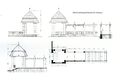
 Denkschrift O. Holzer - vom Friedhof zum Stadtpark, 1910.jpg 5.102 × 6.750; 10,72 MB
 Die freye Reichsstadt Nürnberg mit ihrem Gebiete 1791 (Ausschnitt).png 746 × 842; 1.022 KB
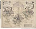 Die verfinsterte Erdkugel 1747.jpeg 1.295 × 1.054; 503 KB
 Die verfinsterte Erdkugel Ausschnitt Schneider.jpg 1.828 × 681; 276 KB
 Districtus Norinbergensis 1650-1698.jpg 1.157 × 1.430; 392 KB
 Draufsicht.jpg 1.390 × 1.012; 256 KB
 DSC03186.Wiki.JPG 3.429 × 1.222; 1,01 MB
 Ducatus Baioariae 1766.png 375 × 237; 161 KB


.png)

.png)


.jpg)


.jpg)


_1662.png)


.png)
.png)
.png)


.png)


